Product Description:
คำอธิบายผลิตภัณฑ์:
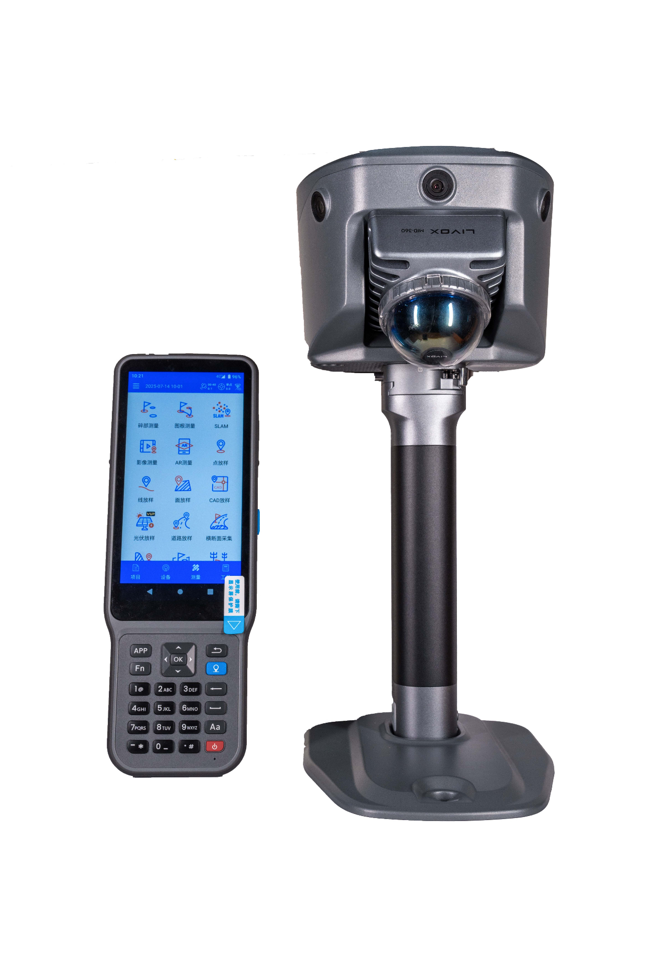
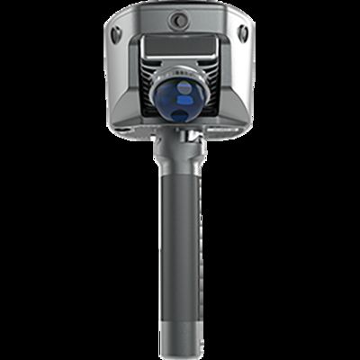
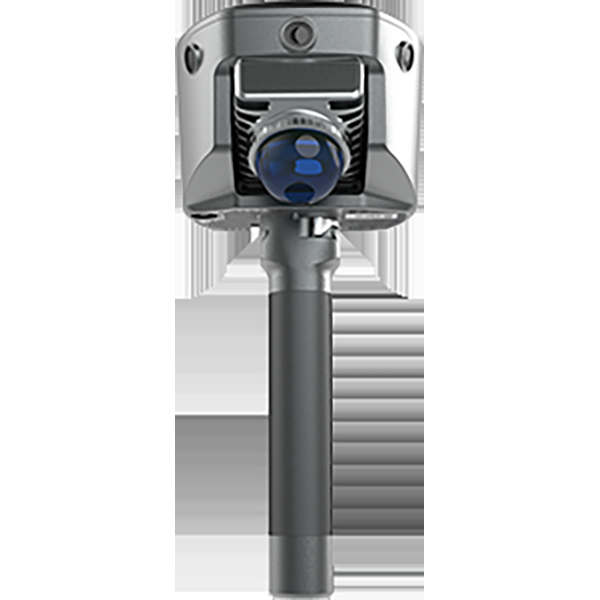
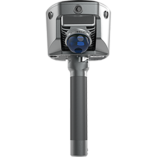
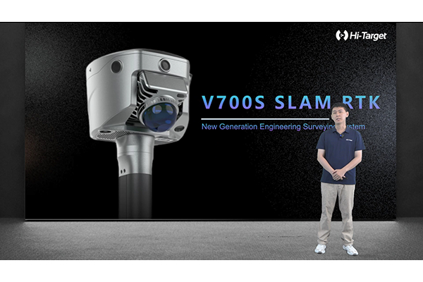
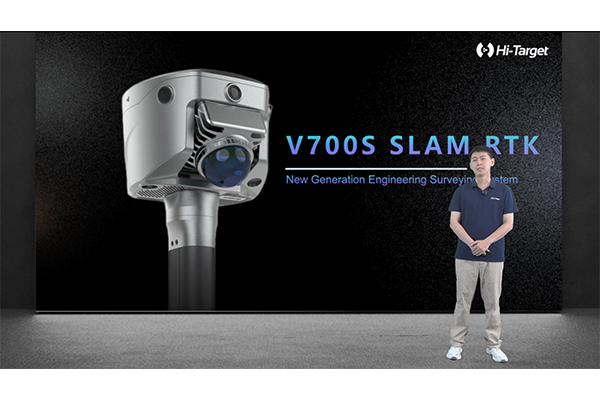
V700S
V700S
Next-Generation Engineering Surveying Solution
โซลูชันการสำรวจทางวิศวกรรมรุ่นต่อไป
The V700S combines cutting-edge RTK and SLAM technologies to achieve centimeter-level accuracy. This advanced integration allows for precise measurements in both open areas and locations where GNSS signals are unavailable, ensuring dependable and efficient surveying under any conditions.
V700S ผสมผสานเทคโนโลยี RTK และ SLAM ที่ทันสมัยเพื่อความแม่นยำระดับเซนติเมตร การผสานรวมขั้นสูงนี้ช่วยให้สามารถวัดได้อย่างแม่นยำทั้งในพื้นที่เปิดโล่งและสถานที่ที่ไม่มีสัญญาณ GNSS ทำให้มั่นใจได้ถึงการสำรวจที่เชื่อถือได้และมีประสิทธิภาพในทุกสภาวะ
Comprehensive Office Software for Data Post-Processing
ซอฟต์แวร์สำนักงานที่ครอบคลุมสำหรับการประมวลผลข้อมูลหลังการประมวลผล
Transform your field-collected data into highly accurate and professional outputs with the accompanying office software. It enables you to create refined point clouds, detailed section drawings, and comprehensive excavation analyses, all maintaining centimeter-level precision to support your engineering projects.
แปลงข้อมูลที่รวบรวมจากภาคสนามของคุณให้เป็นผลลัพธ์ที่มีความแม่นยำสูงและเป็นมืออาชีพด้วยซอฟต์แวร์สำนักงานที่มาพร้อมกัน ช่วยให้คุณสร้างคลาวด์จุดที่ปรับแต่งแล้ว, ภาพวาดส่วนตัดโดยละเอียด, และการวิเคราะห์การขุดค้นที่ครอบคลุม ทั้งหมดนี้ยังคงความแม่นยำระดับเซนติเมตรเพื่อสนับสนุนโครงการวิศวกรรมของคุณ
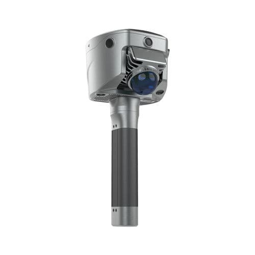
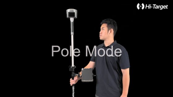
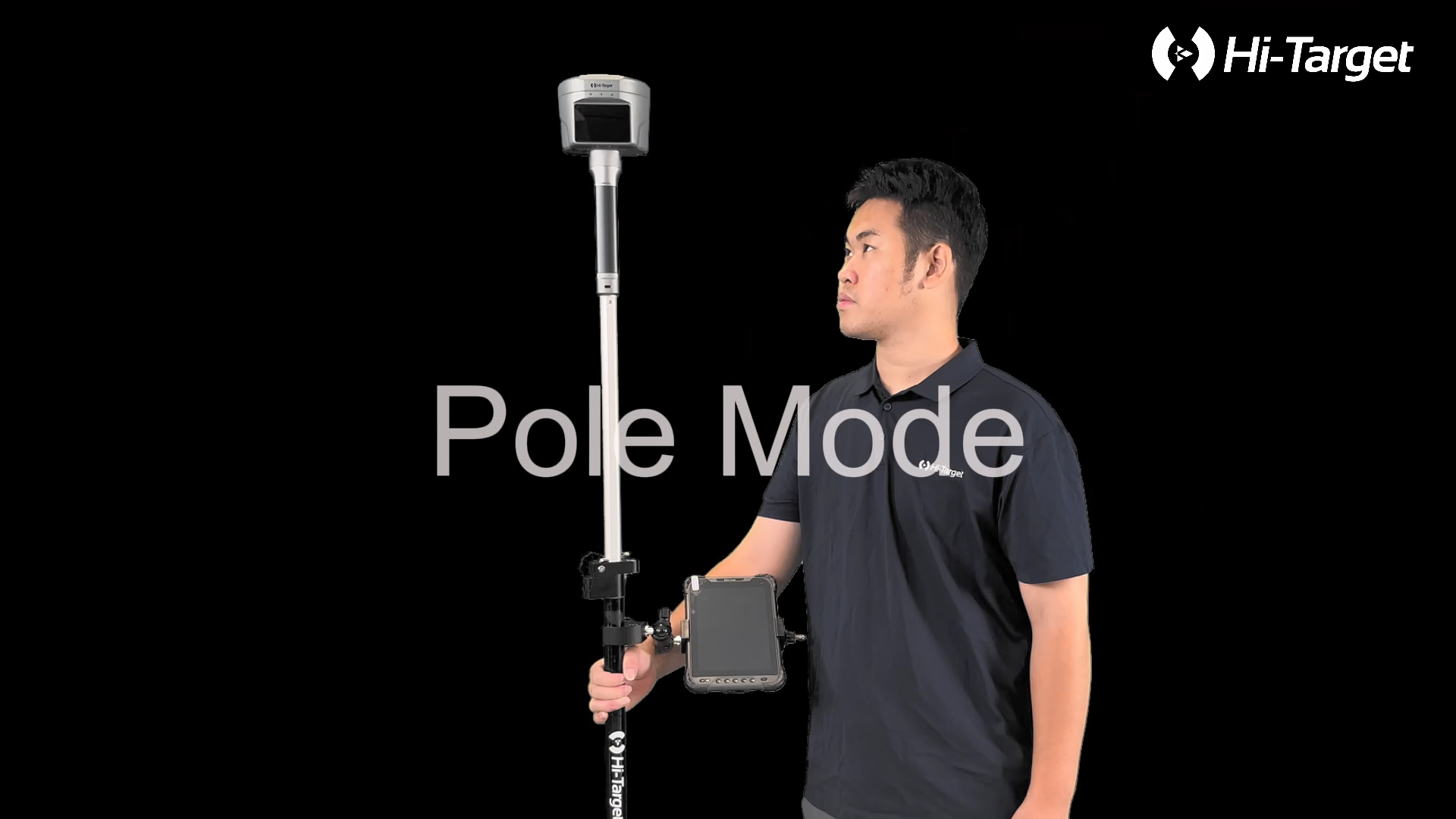
Capture precise measurements effortlessly, even in locations where GNSS signals are unavailable. Whether you are working beneath bridges or inside buildings, our technology allows you to continue your surveying without interruption.
วัดค่าได้อย่างแม่นยำโดยง่าย แม้ในสถานที่ที่ไม่มีสัญญาณ GNSS ไม่ว่าคุณจะทำงานใต้สะพานหรือภายในอาคาร เทคโนโลยีของเราช่วยให้คุณทำการสำรวจได้อย่างต่อเนื่องโดยไม่มีการหยุดชะงัก
Hi-Target’s proprietary Laser Reverse Positioning Technology guarantees accuracy at the centimeter level. This advanced system enables reliable data collection even when satellite signals cannot be received, ensuring your projects stay on track regardless of the environment.
เทคโนโลยี Laser Reverse Positioning ที่เป็นกรรมสิทธิ์ของ Hi-Target รับประกันความแม่นยำในระดับเซนติเมตร ระบบขั้นสูงนี้ช่วยให้สามารถรวบรวมข้อมูลได้อย่างน่าเชื่อถือ แม้ว่าจะไม่สามารถรับสัญญาณดาวเทียมได้ ทำให้มั่นใจได้ว่าโครงการของคุณจะดำเนินต่อไปโดยไม่คำนึงถึงสภาพแวดล้อม
Technical Parameters:
พารามิเตอร์ทางเทคนิค:
Seamless Coordinate System Integration
การรวมระบบพิกัดอย่างราบรื่น
By combining RTK and SLAM technologies, our system delivers precise real-time positioning with a unified coordinate output (BLH/NEZ). This eliminates the need for control points, allowing you to scan effortlessly without the hassle of revisiting previous locations.
ด้วยการรวมเทคโนโลยี RTK และ SLAM ระบบของเราจึงให้ตำแหน่งแบบเรียลไทม์ที่แม่นยำพร้อมเอาต์พุตพิกัดแบบรวม (BLH/NEZ) ซึ่งช่วยลดความจำเป็นในการใช้จุดควบคุม ทำให้คุณสามารถสแกนได้อย่างง่ายดายโดยไม่ต้องยุ่งยากกับการกลับไปที่ตำแหน่งก่อนหน้า
Effortless Contactless Data Collection
การรวบรวมข้อมูลแบบไร้สัมผัสอย่างง่ายดาย
Achieve highly accurate point coordinates simply by taking a photograph. This method enables safe data acquisition from a distance, making it ideal for accessing difficult or dangerous environments without physical contact.
รับพิกัดจุดที่มีความแม่นยำสูงเพียงแค่ถ่ายภาพ วิธีนี้ช่วยให้สามารถรวบรวมข้อมูลได้อย่างปลอดภัยจากระยะไกล ทำให้เหมาะสำหรับการเข้าถึงสภาพแวดล้อมที่ยากลำบากหรือเป็นอันตรายโดยไม่ต้องสัมผัสทางกายภาพ
Applications:
การใช้งาน:
The Hi-LiDAR software enhances real-time data by producing point clouds with an impressive thickness accuracy of less than 2 centimeters and a relative measurement precision of under 1 centimeter. This level of detail ensures highly reliable and precise spatial data for various applications.
ซอฟต์แวร์ Hi-LiDAR ช่วยเพิ่มข้อมูลแบบเรียลไทม์ด้วยการสร้างคลาวด์จุดที่มีความแม่นยำของความหนาน้อยกว่า 2 เซนติเมตร และความแม่นยำในการวัดสัมพัทธ์น้อยกว่า 1 เซนติเมตร รายละเอียดระดับนี้ช่วยให้มั่นใจได้ถึงข้อมูลเชิงพื้นที่ที่น่าเชื่อถือและแม่นยำสูงสำหรับการใช้งานต่างๆ
One of the key features of the software is its automated excavation analysis capability. It accurately calculates the extent of over-excavation and under-excavation in tunnel sections, which helps in monitoring construction progress and validating the work completed. This automation streamlines project management and ensures adherence to planned specifications.
หนึ่งในคุณสมบัติหลักของซอฟต์แวร์คือความสามารถในการวิเคราะห์การขุดค้นอัตโนมัติ ซึ่งคำนวณขอบเขตของการขุดเกินและการขุดไม่ถึงในส่วนอุโมงค์ได้อย่างแม่นยำ ซึ่งช่วยในการตรวจสอบความคืบหน้าของการก่อสร้างและตรวจสอบความถูกต้องของงานที่เสร็จสิ้น การทำงานอัตโนมัตินี้ช่วยปรับปรุงการจัดการโครงการและรับประกันการปฏิบัติตามข้อกำหนดที่วางแผนไว้
Additionally, Hi-LiDAR offers advanced visualization and drafting tools for sectional views. It supports both horizontal and vertical sections, making it particularly useful for renovation projects involving older buildings. These features provide precise architectural measurements that assist in effective planning and execution of renovation tasks.
นอกจากนี้ Hi-LiDAR ยังมีเครื่องมือการสร้างภาพและการร่างภาพขั้นสูงสำหรับมุมมองส่วนตัด รองรับทั้งส่วนแนวนอนและแนวตั้ง ทำให้มีประโยชน์อย่างยิ่งสำหรับโครงการปรับปรุงอาคารเก่า คุณสมบัติเหล่านี้ให้การวัดทางสถาปัตยกรรมที่แม่นยำ ซึ่งช่วยในการวางแผนและการดำเนินการปรับปรุงอย่างมีประสิทธิภาพ
Customization:
การปรับแต่ง:
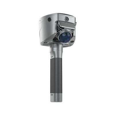
Introducing the Hi-target V700S 3D Laser Scanner, a cutting-edge product originating from China and certified with CE standards. This advanced laser scanner supports SLAM technology, ensuring precise and efficient mapping and scanning processes. With a relative accuracy of 2cm, the V700S delivers reliable results suitable for various professional applications.
ขอแนะนำ Hi-target V700S 3D Laser Scanner ผลิตภัณฑ์ล้ำสมัยที่มาจากประเทศจีนและได้รับการรับรองตามมาตรฐาน CE เครื่องสแกนเลเซอร์ขั้นสูงนี้รองรับเทคโนโลยี SLAM ทำให้มั่นใจได้ถึงกระบวนการทำแผนที่และการสแกนที่แม่นยำและมีประสิทธิภาพ ด้วยความแม่นยำสัมพัทธ์ 2 ซม. V700S ให้ผลลัพธ์ที่เชื่อถือได้ เหมาะสำหรับการใช้งานระดับมืออาชีพต่างๆ
The Hi-target V700S is compatible with multiple operating systems, including Windows, Mac, and Linux, providing versatile integration options for different workflows. Designed in a sleek gray color with 3D dimensions, this model offers both functionality and aesthetic appeal.
Hi-target V700S เข้ากันได้กับระบบปฏิบัติการหลายระบบ รวมถึง Windows, Mac และ Linux ซึ่งมีตัวเลือกการผสานรวมที่หลากหลายสำหรับเวิร์กโฟลว์ที่แตกต่างกัน ออกแบบด้วยสีเทาที่ดูโฉบเฉี่ยวพร้อมขนาด 3 มิติ รุ่นนี้ให้ทั้งฟังก์ชันการทำงานและความสวยงาม
Our product customization services include options to enhance your scanning capabilities with RTK and SLAM integration, allowing for improved positioning accuracy and seamless data collection. Whether you require SLAM-only configurations or combined RTK and SLAM solutions, we tailor the V700S to meet your specific needs.
บริการปรับแต่งผลิตภัณฑ์ของเรามีตัวเลือกในการปรับปรุงความสามารถในการสแกนของคุณด้วยการผสานรวม RTK และ SLAM ทำให้สามารถปรับปรุงความแม่นยำในการวางตำแหน่งและการรวบรวมข้อมูลได้อย่างราบรื่น ไม่ว่าคุณจะต้องการการกำหนดค่า SLAM เท่านั้น หรือโซลูชัน RTK และ SLAM แบบรวม เราปรับแต่ง V700S ให้ตรงกับความต้องการเฉพาะของคุณ
We offer a minimum order quantity of 1 unit, priced at 6800 USD, with secure packaging using plastic and carton materials to ensure safe delivery. The typical delivery time ranges from 3 to 5 days, and payment terms are flexible with T/T accepted.
เรามีปริมาณการสั่งซื้อขั้นต่ำ 1 หน่วย ราคา 6800 USD พร้อมบรรจุภัณฑ์ที่ปลอดภัยโดยใช้พลาสติกและวัสดุกระดาษแข็งเพื่อความปลอดภัยในการจัดส่ง โดยทั่วไประยะเวลาการจัดส่งจะอยู่ระหว่าง 3 ถึง 5 วัน และเงื่อนไขการชำระเงินมีความยืดหยุ่น โดยยอมรับ T/T
Choose the Hi-target V700S 3D Laser Scanner for reliable SLAM-based scanning solutions backed by professional customization services to optimize your surveying and mapping projects.
เลือก Hi-target V700S 3D Laser Scanner สำหรับโซลูชันการสแกนแบบ SLAM ที่เชื่อถือได้ ซึ่งได้รับการสนับสนุนจากบริการปรับแต่งระดับมืออาชีพเพื่อเพิ่มประสิทธิภาพโครงการสำรวจและทำแผนที่ของคุณ
Support and Services:

 ข้อความของคุณจะต้องอยู่ระหว่าง 20-3,000 ตัวอักษร!