รายละเอียดสินค้า:
จุดเด่น
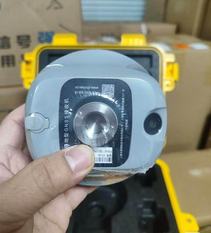
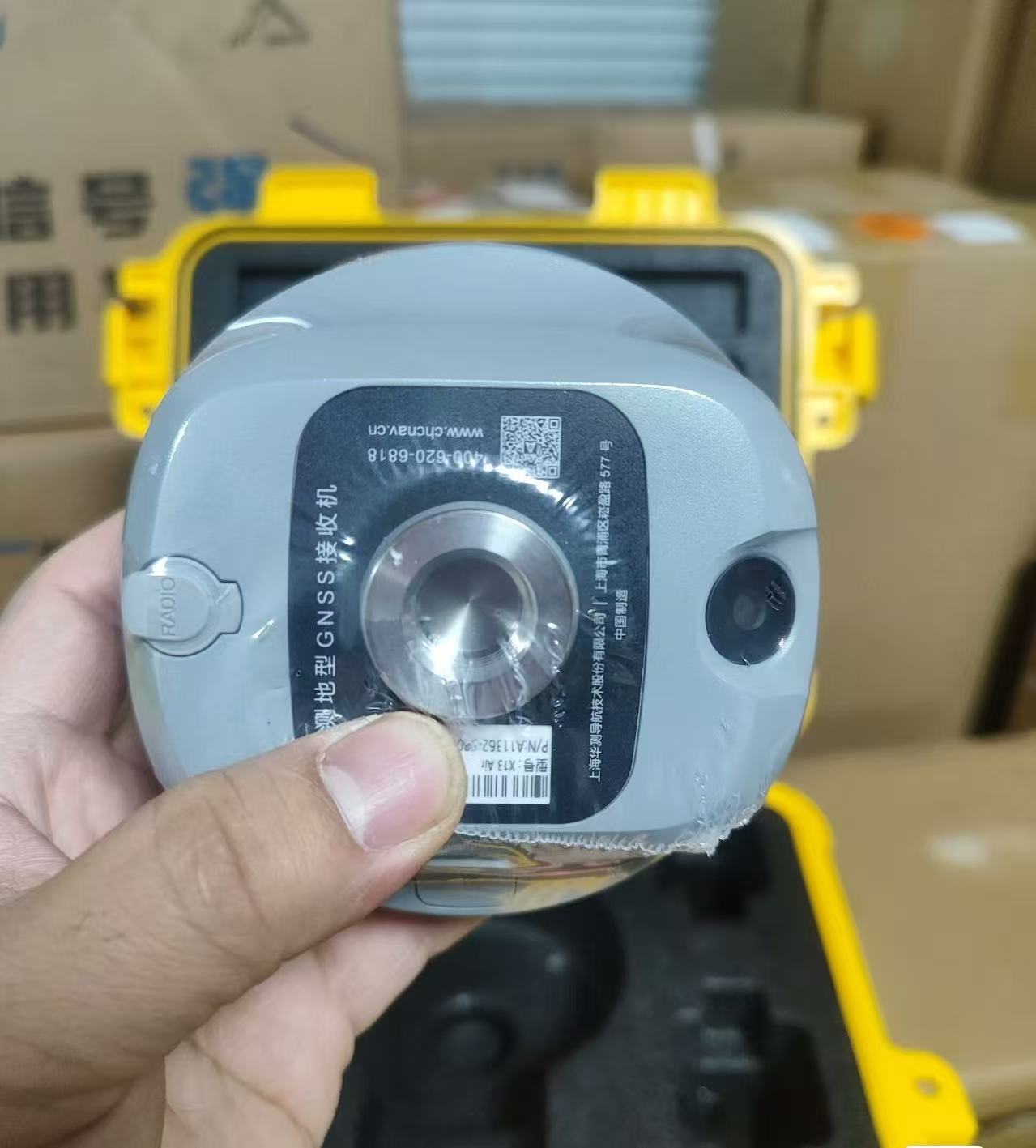
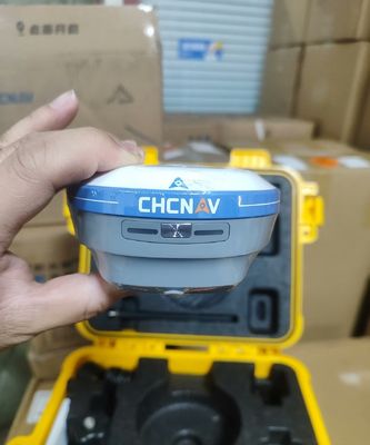
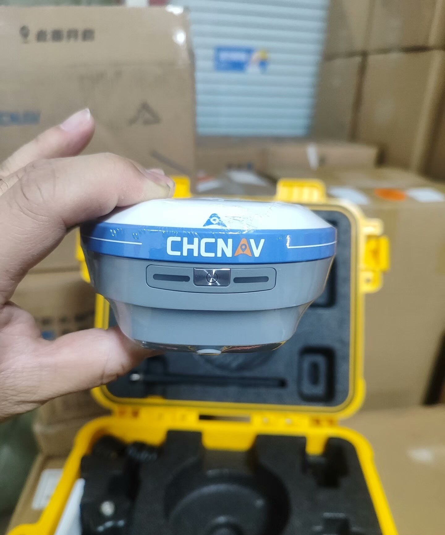
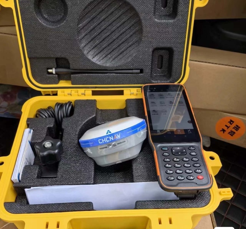
The i76 Palm Visual RTK เป็นเครื่องรับน้ำหนักเบาที่รวม GNSS, IMU และกล้องคู่ น้ำหนักเพียง 450 กรัมและมีระดับ IP68 อุปกรณ์นี้ยังคงอัตราคงที่ 96% แม้ในพื้นที่ที่มีกิจกรรมแสงอาทิตย์สูง
ด้วยความสามารถในการวางตำแหน่งภาพ CAD AR สำหรับการวางแผนเส้นทางที่แม่นยำและ Ultra-IMU รุ่นที่ 5 ที่รับประกันความแม่นยำสูงถึง 60° i76 มอบทั้งความแม่นยำและความสามารถในการปรับตัวให้กับผู้เชี่ยวชาญที่ต้องการประสิทธิภาพที่เชื่อถือได้ในการทำงานด้วยอายุการใช้งานแบตเตอรี่ที่น่าทึ่งกว่า 17 ชั่วโมง
i76 มอบทั้งความแม่นยำและความสามารถในการปรับตัวให้กับผู้เชี่ยวชาญที่ต้องการประสิทธิภาพที่เชื่อถือได้ในการทำงานคุณสมบัติ:
เพิ่มประสิทธิภาพการวางตำแหน่งโดยรวม 40% ด้วยการวางตำแหน่งภาพ CAD AR เทคโนโลยีนี้ผสานรวมแผนที่ฐานเข้ากับความเป็นจริงเสริม (AR) เพื่อการวางแผนเส้นทางที่แม่นยำและการแสดงภาพแบบเรียลไทม์
บรรลุความแม่นยำที่เหนือกว่าด้วยเสาอากาศ GNSS รุ่นที่ 4 และเทคโนโลยี iStar 2.0 i76 ให้ RTK คงที่ที่เชื่อถือได้มากกว่า 96% ในภูมิภาคที่มีกิจกรรมแสงอาทิตย์สูง ทำให้มั่นใจได้ถึงข้อมูลที่เชื่อถือได้
เพิ่มความแม่นยำในการวัด 30% ด้วย Ultra-IMU รุ่นที่ 5 มีการชดเชยการเอียงเสาอัตโนมัติสูงถึง 60° ทำให้มั่นใจได้ถึงความแม่นยำภายใน 3 ซม. โดยไม่ต้องเริ่มต้นด้วยตนเอง
i76 ผสานรวม GNSS, IMU และกล้องมุมกว้างคู่ ทำให้ได้รับประสบการณ์การสำรวจที่ราบรื่น ระบบรองรับการวางตำแหน่งและการวัดแบบเรียลไทม์พร้อมการตอบสนองด้วยภาพที่ใช้งานง่าย
เพลิดเพลินกับการจัดการและความคล่องตัวที่ง่ายดายด้วย i76 ขนาดฝ่ามือ น้ำหนักเพียง 450 กรัม การออกแบบที่กะทัดรัดทำให้เบากว่ามาตรฐานอุตสาหกรรม 40% และเล็กกว่า 50% ช่วยเพิ่มประสิทธิภาพการทำงานภาคสนาม
ทนทานต่อสภาพแวดล้อมที่รุนแรงด้วยระดับ IP68 ของ i76 และทนต่อการตกจากระยะ 2 เมตร โครงสร้างไบโอมิเมติกและเลนส์แซฟไฟร์ช่วยให้มั่นใจถึงความทนทาน ทำให้เหมาะสำหรับสภาพสนามที่ยากลำบาก
พารามิเตอร์ทางเทคนิค:
ช่อง:
| 226 ช่อง GNSS |
แหล่งจ่ายไฟภายนอก: |
| 9.0 – 27.0 V DC |
ความแม่นยำแบบคงที่: |
| H: 3 มม. + 0.1 ppm | V: 3.5 มม. + 0.4 ppm |
IRNSS (NavIC): |
| SPS-L5 |
BeiDou: |
| B1, B2 |
คงที่/คงที่เร็ว*: |
| H: 3 มม. + 0.4 ppm | V: 5 มม. + 0.5 ppm |
L-band: |
| ใช่ |
SBAS: |
| WAAS/EGNOS/MSAS |
แบตเตอรี่: |
| Li-ion 11,600 MAh, 3.7 V |
GLONASS: |
| L1 C/A, L1P, L2C/A, L2P, L3C |
แอปพลิเคชัน: |
เครื่องรับ CHCNAV i76 RTK GNSS เป็นเครื่องรับ GPS ความแม่นยำสูงที่เหมาะสำหรับแอปพลิเคชันและสถานการณ์ที่หลากหลาย คุณสมบัติขั้นสูงและประสิทธิภาพที่เชื่อถือได้ทำให้เหมาะสำหรับอุตสาหกรรมและผู้เชี่ยวชาญต่างๆ นี่คือโอกาสและสถานการณ์การใช้งานผลิตภัณฑ์บางอย่างที่สามารถใช้ CHCNAV i76 ได้อย่างมีประสิทธิภาพ:
1. การสำรวจที่ดิน:
เครื่องรับ i76 RTK GNSS เหมาะอย่างยิ่งสำหรับงานสำรวจที่ดินที่ต้องการความแม่นยำสูง สามารถใช้สำหรับการทำเครื่องหมายขอบเขต การทำแผนที่ภูมิประเทศ และการวางผังการก่อสร้างได้อย่างง่ายดาย2. การก่อสร้าง:
ผู้เชี่ยวชาญด้านการก่อสร้างสามารถได้รับประโยชน์จากความสามารถแบบเรียลไทม์ (RTK) ของ i76 สำหรับงานต่างๆ เช่น การเตรียมพื้นที่ การปรับเกรด และการก่อสร้างอาคาร โหมดคงที่ที่รวดเร็วช่วยให้มั่นใจได้ถึงตำแหน่งที่แม่นยำสำหรับการวางตำแหน่งและการสำรวจตามที่สร้างขึ้น3. การเกษตร:
เกษตรกรและผู้เชี่ยวชาญด้านการเกษตรสามารถใช้ประโยชน์จาก i76 สำหรับแอปพลิเคชันการทำฟาร์มแบบแม่นยำ เช่น การทำแผนที่พื้นที่ การตรวจสอบพืชผล และการวางแผนการระบายน้ำ การรองรับ L-band ช่วยให้มั่นใจได้ถึงการรับสัญญาณที่เชื่อถือได้แม้ในสภาพแวดล้อมที่ท้าทาย4. การพัฒนาโครงสร้างพื้นฐาน:
i76 เหมาะสำหรับโครงการพัฒนาโครงสร้างพื้นฐาน เช่น การก่อสร้างถนน การสร้างสะพาน และการทำแผนที่สาธารณูปโภค ความสามารถในการทำงานกับระบบดาวเทียมหลายดวง เช่น Galileo และ IRNSS (NavIC) ช่วยให้มั่นใจได้ถึงประสิทธิภาพสูงสุดในสภาพแวดล้อมที่หลากหลาย5. การรวบรวมข้อมูล GIS:
ผู้เชี่ยวชาญด้าน GIS สามารถใช้ i76 สำหรับการรวบรวมข้อมูลและการทำแผนที่ที่แม่นยำ ความเข้ากันได้กับสัญญาณ GNSS ต่างๆ รวมถึง GPS, Galileo และ IRNSS ช่วยให้สามารถวางตำแหน่งและการวัด AR ได้อย่างแม่นยำด้วยการรับรอง CE และต้นกำเนิดจากประเทศจีน เครื่องรับ CHCNAV i76 RTK GNSS มีปริมาณการสั่งซื้อขั้นต่ำ 1 หน่วยในราคาที่แข่งขันได้ 1480 USD เงื่อนไขการชำระเงินคือ 100% T/T ทำให้ลูกค้าได้รับเครื่องรับ GPS คุณภาพสูงนี้ได้อย่างสะดวก ไม่ว่าคุณต้องการการวางตำแหน่งมุมมองสด การวัด AR หรือความสามารถแบบคงที่/คงที่อย่างรวดเร็ว i76 เป็นโซลูชันที่เชื่อถือได้และมีประสิทธิภาพสำหรับความต้องการในการวางตำแหน่งของคุณ

 ข้อความของคุณจะต้องอยู่ระหว่าง 20-3,000 ตัวอักษร!